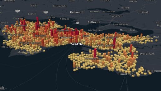
Azure Maps API’s power Geospatial Data Analytics
Accurate analytics are a necessity in an increasingly complex business landscape. Azure Maps APIs help deliver location analytics whether in Microsoft Fabric, Power BI or in custom stand alone applications. Organizations can parse and interpret massive amounts of location data from multiple sources, including IoT sensors, to zero in on the insights that truly matter.
Unified on Azure
Azure Maps APIs let you skip the hassle of using multiple platforms to collect, process and analyze location data. Get everything you need all in one place.
Real-time Analytics with Fabric
Stream real-time analytics capabilities are unmatched, from building optimized routes with real-time traffic data to accurate asset tracking.
Location Analytics in Power BI
Make a bigger impact with powerful data visualization tools on Power BI. Use a variety of interactive map styles to tell a story with every dataset.
Infinite Scale on Azure
Working with Azurelets businesses analyze vast amounts of geospatial information. Scale your Geospatial Data Analytics as needed.
Built for data analytics

Data and Insights
Use location analytics and rich geospatial data to extract unique and invaluable insights. Make every map matter with peerless analytics.

Location Services
Locate addresses and points of interest around the world in the blink of an eye with precise geocoding and reverse geocoding services.

Mapping and Visualization
Employ custom colors, markers, and styles to effectively present your geographic data to different audiences.
Frequently asked questions
-
Geospatial analysis can be a complete game-changer for most businesses. Here’s a glimpse:
- Optimizing routes to shorten delivery times
- Enhancing the customer experience through personalized, location-based offers
- Mitigating and managing business risk with proactive mapping solutions
-
Getting started with Azure Maps is an incredibly simple process. Sign up for a free Azure subscription, create an Azure Maps instance, and pick a subscription or use managed identities. You’re all set to build!
-
Azure Maps supports a wide variety of data types. For instance, you can perform GIS data analysis with:
- Traffic data like historical traffic patterns and road closures
- Environmental data like air quality metrics and weather
- Demographic data like population density and age distribution
-
Absolutely! Integrating Azure Maps with an existing piece of software or app is as easy as it gets. You’ll be able to start using our analytics features right after signing up. For additional developer support, you can always rely on our documentation base and code samples.


