Geocoding is a crucial component for any application that uses location data, from tracking deliveries to managing assets. This guide will demystify the geocoding process, explaining what geocoding is, its benefits, and how to get started using a geocoding API.
What is geocoding?
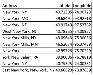
Geocoding essentially translates text-based addresses or place names into precise geographical coordinates (latitude and longitude). In practice, it’s like turning a street address into a precise pinpoint on a map. The reverse process, converting coordinates back into text-based descriptions, is called reverse geocoding.
Geocoding sounds simple enough at first glance, but there’s a ton of variability that can creep in depending on the caliber of the API you’re using. An accurate geocoding system goes beyond simply obtaining an API key and entering a list of addresses.
The quality of the input address data is crucial. Typos or incomplete addresses can lead to incorrect results if your API doesn’t support reliable fuzzy search. Additionally, the time taken to process a batch of addresses can vary significantly based on the API. Other technical bottlenecks, like limits on the number of inputs, are also worth noting.

Geocoding basics
It’s worth taking the time to understand what geocoding is and how it really works before you get an API key. At its core, a geocoder relies on two key components: an input dataset and a geocoding algorithm. The input data (text-based addresses) in a geocoding system can be of two types:
- Relative: These addresses are dependent on another location, making them more challenging for geocoders to interpret. For example, ‘the building across from the bakery’ relies on first locating the bakery. The precision of relative geocodes can vary significantly compared to absolutes, but it’s getting better every day as geocoding APIs improve their algorithms.
- Absolute: These text-based addresses are self-contained and do not depend on a reference. For example, ‘Truman Bakery 23rd St. 10011’.
Once the input data is received, the geocoding algorithm takes over. This algorithm uses sophisticated techniques to match the input address with corresponding coordinates in its internal database. Note that complications can arise even with absolute input data in a geocoding system due to:
- Incomplete mapping (street addresses and other key locations that haven’t been mapped yet)
- Inconsistent input data formats
- Incorrect input data (misspelled addresses or incorrect reference locations)
So, what is a geocoding service going to do to navigate those complications? Some APIs will rely on GPS when they lack reliable reference data, while others will use a mix of interpolation and GPS.
The Azure Maps API Geocoding Service
The Azure Maps Geocoding APIs offer a suite of location services that enable the fast and accurate geocoding of hundreds of addresses at a time. Each geocode request sent through this geocoding system can be modified extensively to suit the developer’s needs. Developers can define bounding boxes to focus on a specific geographical area, adjust the language of the responses, and so much more.
There are no limits on the number of requests that can be made every day. Instead, there are limits on the overall queries per second (QPS) depending on your pricing tier. You can learn more about QPS limits with our geocoding documentation.
Creating a batch geocode request
Once you’ve signed up for Azure Maps and retrieved your subscription key, you can create your first batch geocode request. Here’s what you need to know about the batch geocoding system:
- Formatting: If you know what geocoding is and how it works, you already understand the importance of proper formatting. You’ll want to create a list or array containing your addresses in the desired format. Ensure your addresses are formatted consistently.
- Create a Request: The Get Batch Geocoding API uses POST requests to send queries. A synchronous batch request is optimal for lightweight batches, and it supports up to 100 addresses per request.
Your request body will include the list of addresses you prepared earlier. This body should include at least one item. You can use different URL parameters to customize your request. For example, “adminDistrict”: “WA” will constrain the results to the Washington district.
- Send Request: Once you’ve sent your request, our geocoding system will return a response containing coordinates for your input data as quickly as possible. This time can vary based on the total amount of addresses in a request. The response will include components like totalRequests and successfulRequests to indicate the number of addresses that have successfully been geocoded.
And you’re set! You can now use those coordinates in your application. Whether you’re planning a route for hundreds of delivery agents or optimizing travel times for commuters, you’ll be working with accurate geospatial data.
Check out our Get Batch Geocoding API documentation for a more in-depth look at our geocoding system and to learn more about what batch geocoding is. This documentation also includes code snippets you can use for your own request.

The many applications of geocoding
The Azure Maps Geocoding API can be used to solve a wide range of challenges in various industries. Let’s take a look at some key examples:
- Data Management: Geocoding can be vital in effective spatial data management as organizations scale up. Long text-based addresses are incredibly time-consuming to work with and create a greater margin for human error. This is particularly true for organizations working across multiple regions or even countries.
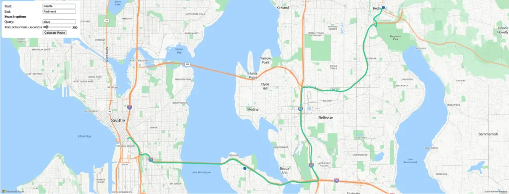
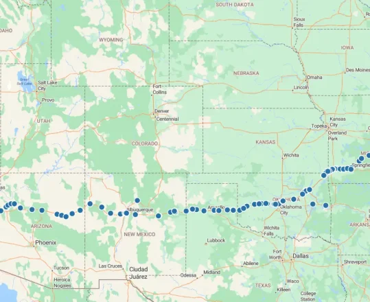
This input data is also surprisingly bulky. As this data size increases, it’ll also take longer for servers to look for and fetch this information when queried. Geocoding systems turn addresses into coordinates that can be easily compressed, manipulated, and retrieved. - Operations: Logistics companies can leverage geocoded data to create dynamic routes that avoid traffic congestion and optimize delivery schedules. This data can also be used to optimize service delivery. Operators can track the location of hundreds of agents at a time to determine the optimal response to a request.
- Spatial Analysis and Decision-Making: Geocoding is what allows thousands of successful organizations to make successful decisions, backed by geospatial data. Cumbersome lists containing customer locations across multiple regions can easily be geocoded and converted into a heatmap with a visualization tool.
Get started today
Create a robust solution backed by a precise geocoding system today. Sign up for a free Azure Maps account and get your API key to start building. Get $200 in free Azure credit when you sign up.


